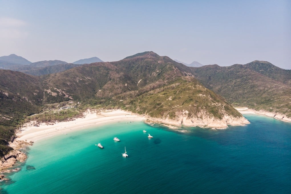
Explainer | Hiking the MacLehose: a guide to sections 1, 2 and 3 – iconic dams, stunning beaches and mountains
- The MacLehose Trail stretches almost 100km across Hong Kong and offers stunning views of beaches and mountain tops
- This guide includes photos, videos and descriptions for you to enjoy the country parks with ease
The MacLehose Trail is Hong Kong’s most iconic hiking route. It stretches 98km from Sai Kung to Tuen Mun. Here is the ultimate guide from sections 1 to 3, which you can do individually, group them together, or all at once in an epic ultra adventure.
Section 1, 10km – estimated time to complete: two to three hours
The MacLehose starts at Pak Tam Chung, near Sai Kung. You can take the MTR to Hang Hau, then a taxi to the start. Or take the 101 minibus to Sai Kung Town and take a taxi or bus from there. Once you reach Pak Tam Chung, pass the car barrier and keep walking straight along the concrete road. There are markers displaying a hiker about every 500m for the entire trail.
The trail officially starts a few hundred metres down the road, so stop to take a picture by the sign to mark the start of your adventure.

10:02
Hiking Hong Kong’s MacLehose Trail
After a short hill, there is a roundabout. Turn right, and then it is a simple but long concrete road across three stunning dams. After the roundabout, it is hard to go wrong.
